الثلاثاء، 19 يناير 2021

The SFMTA and San Francisco Beautiful Kick Off Muni Art Project 2021

The SFMTA and San Francisco Beautiful Kick Off Muni Art Project 2021
By Jeanne Brophy

The SFMTA and San Francisco Beautiful  announce the kick-off of the 2021 Muni Art Project.  This year the program launch will be held virtually due to COVID-19 shelter-in-place orders.

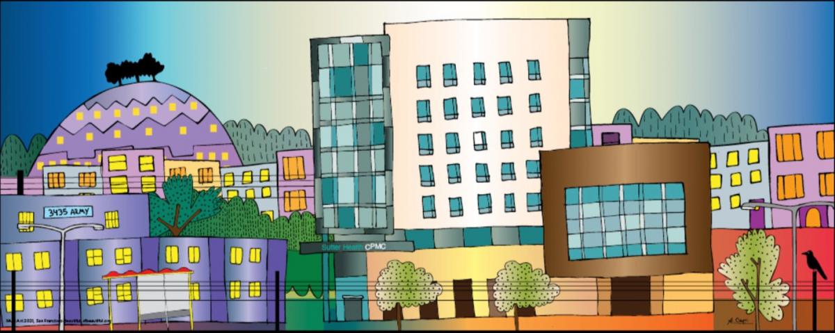
Artwork by Agustina Caprioglio who found inspiration from COVID-19 and the frontline staff in hospitals,

Artwork by Agustina Caprioglio who found inspiration from COVID-19 and the frontline staff in hospitals, “They are our modern-day temples,” she states, “where people are born and die, where doctors and nurses work hard to take care of all”.

The 2021 theme, “San Francisco United” is the sixth year that the SFMTA, San Francisco Beautiful and The Poetry Society of America (sponsors of Poetry in Motion ®) have collaborated to bring art and poetry to Muni riders.  

“Now more than ever—it’s important to appreciate and be thankful for the positives around us,” said Jeffrey Tumlin, SFMTA Director of Transportation. “That’s why we’re looking forward to bringing Muni Art back and sparking some joy in the wake of such a difficult year.”

Begun in 2015, Muni Art is the only public art project that exclusively features San Francisco artists and poets. The artists’ original work and five poems selected by the Poetry Society of America, is presented on 100 Muni buses throughout San Francisco from January through April, 2021.

Art is the one language that unites everyone," said Darcy Brown, Executive Director of San Francisco Beautiful. "We all have lost so much, Muni Art 2021 is one project we didn't lose. We celebrate our local artists and poets and San Francisco.

The 2021 Muni artists are:

  • Kundan Baidwan
  • Agustina Caprioglio
  • John Keating
  • Deirdre Weinberg
  • Wes Wellner

The 2021 Muni poets and poems are:

  • Kim Addonizio
  • Derrick Austin
  • Jennifer Elise Foerster
  • Thom Gunn
  • Gary Soto

In addition to the poet panels, each artist also has three panels to freely use reflecting the theme for a total of eight original works that will line both interior display sides of the buses and conform to the specifications of Muni display space. In addition, each artist will be awarded $1,000.

For more details on the winners of the Muni Art Project, please visit www.sfbeautiful.org/MuniArt. Examples of each artist’ work can be found at SFMTA.com/MuniArt.


Published January 19, 2021 at 05:26PM
https://ift.tt/2NjHwwR

الجمعة، 15 يناير 2021

The Embarcadero Enhancement Project: Creating a Safe and Lively Waterfront

The Embarcadero Enhancement Project: Creating a Safe and Lively Waterfront
By Benjamin Barnett

As people walking, on bikes, scooters, and in motor vehicles all compete for space on the Embarcadero, travel along the waterfront can be challenging and create conflicts, especially at peak times. To address this, the SFMTA initiated The Embarcadero Quick-Build Project in 2020 as the first part of a larger plan to improve safety and livability on that corridor.

Safety and mobility improvements have so far been completed at Pier 35, the Ferry Terminal, and in the Rincon Restaurant Zone. These projects improve the safety and enjoyment of all modes of travel and mark a pivotal starting point in creating an improved waterfront for everyone to use.

Just the Start
The next step in connecting and extending these quick-build improvements is the implementation of an even more ambitious plan, The Embarcadero Enhancement Project (EEP). On Tuesday, January 12, the SFMTA presented the phasing plan of the EEP, including details of Phase 1, to the Port Commission. The plan prioritizes the next phases of infrastructure development that will occur along the corridor.

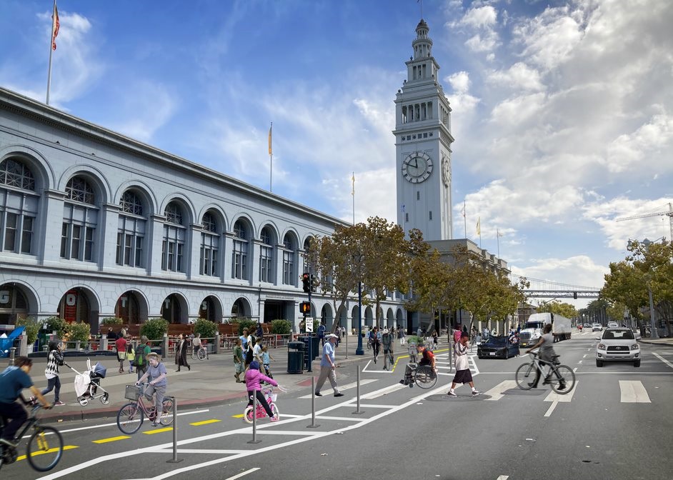
Rendering of proposed improvements on the Embarcadero at Ferry Building Plaza, showing two way bike lanes in front of the Ferry Terminal
Rendering of Phase 1 of safety improvements on the Embarcadero at Ferry Building Plaza

Safety and Mobility
The Embarcadero corridor between Townsend and Lombard streets is part of San Francisco’s Vision Zero High Injury Network (HIN), the 13 percent of streets accounting for 75 percent of severe and fatal traffic injuries. Sadly, 174 severe injury collisions and two fatalities have taken place along this corridor in the last five years. To achieve our Vision Zero safety goals of eliminating all traffic fatalities, the SFMTA will deliver the greater Embarcadero Enhancement Project through our on-going partnership with the Port of San Francisco and the input of community stakeholders. The Embarcadero Enhancement Project seeks to:

  • Build a safer Embarcadero for all users
  • Improve connections between the Embarcadero and nearby neighborhoods
  • Elevate the Embarcadero’s role as a valued destination and workplace for locals, visitors, businesses, maritime and industrial uses
  • Invest in critical infrastructure to support the renewal and recovery of our City while protecting public health

Upcoming Phases
The first phase will take place along the Central Segment between Mission Street and Broadway. The second phase will focus along the Southern Segment between Folsom and Townsend streets.

Phase 1 - Central Segment (Mission to Broadway)
The first phase (Central Segment) will be constructed in two parts, with less-intensive construction to occur in 2021, using “quick-build” techniques and city crews, followed by more substantial capital investment and construction.

This sequenced approach allows for timely implementation of key safety measures and expanded mobility options during the pandemic-related temporary shutdown of historic streetcar service. It also allows the project team time to observe and evaluate these changes prior to committing to more permanent and expensive streetscape features.

Phase 2 - Southern Segment (Mission to Townsend)
The second phase (Southern Segment) proposes to extend the quick-build and Central Segment improvements south toward the ballpark, Caltrain, and growing Mission Rock neighborhood. This phase requires more significant capital investment and changes to the existing promenade and center medians to accommodate a fully protected two-way bikeway. As such, Phase 2 has a longer and less certain timeframe. SFMTA staff are undertaking preliminary engineering and will be coordinating with the Port’s development plans for Piers 30-32 and 38-40.

Northern Segment (Broadway to North Point)
The Embarcadero Enhancement Project's preliminary engineering phase identified several design and funding challenges to implementing the project as envisioned along The Embarcadero north of Broadway.  This segment will not move forward as part of the EEP, but the SFMTA together with the Fisherman’s Wharf/Pier 39 circulation study will perform additional public outreach and analysis later this year to determine what safety improvements might be feasible in that area.

Stay Informed as We Create a Safer Embarcadero
The Embarcadero is a special place for many in San Francisco and beyond. We look forward to engaging with the community in the months ahead to help this important project take shape. Outreach for Phase 1 is currently underway through the spring of 2021. Please visit our project website at SFMTA.com/Embarcadero to stay up to date on the latest information and sign up for updates, or contact the project team directly by emailing Embarcadero@SFMTA.com.

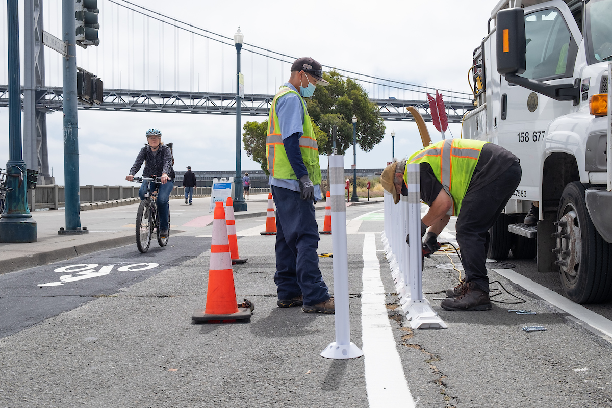
Sign Shop Crew Installing Safe Hit Posts Along New Bicycle Facilities on Embarcadero
SFMTA Sign Shop crew installing safety posts along the Embarcadero bicycle lane in August 2020.


Published January 15, 2021 at 04:59PM
https://ift.tt/2XKO5KE

الخميس، 14 يناير 2021

Renewing San Francisco’s Subway for the 21st Century

Renewing San Francisco’s Subway for the 21st Century
By Jerri Diep

The Muni Metro system operates underground from Embarcadero to West Portal in tunnels that were constructed between 50 to 100 years ago. Considering their age and history, SFMTA has undertaken a Subway Renewal Program to ensure that this vital segment of our transportation network is brought into a state-of-good repair.

The SFMTA kicked off the first part of the Subway Renewal Program during the current shutdown, which began as a result of the pandemic in March 2020. Work is underway to improve the reliability of the system and reduce disruptions for years to come. While we had hoped to complete all the near-term items we identified during our evaluation period by the end of 2020, designing and procuring some of the more complex elements is taking longer than expected. As a result, some of that initial work will continue even as service is restored.

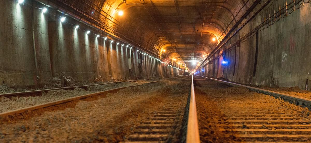
Photo of rails in subway tunnel with construction vehicle

Track maintenance work being undertaken prior to the return of Muni light-rail to the subway

The Subway Renewal Program lays out a systematic approach to capital upgrades over the next ten years, targeting a backlog of repairs on the most critical systems. This work will improve our subway’s resilience and prepare it for the demands of the future. Additionally, the program provides a framework for future capital work by emphasizing continuous upgrades, as well as identifying replacement needs early and ensuring they are addressed promptly.  The critical subway infrastructure items we will replace over the next ten years include tangent (straight-line) track, crossover tracks and switches. We will also upgrade our electrical systems in the subway stations, enhance ventilation and replace and upgrade our automatic train control system. Long-awaited Wi-Fi connection inside the subway tunnel is already underway and is scheduled for completion prior to the subway reopening.

We will provide more information on future construction work as it becomes available. Stay tuned! 

Current Subway Work Details

The work of our engineering and maintenance teams on Subway Renewal includes:

  • Replacing defective splices on the overhead lines, installing new wire to reduce frequency of splices and redesigning support structures to optimize alignment, eliminating slow zones
  • Grinding rail to reduce wear on rolling stock, improve ride quality, and extend life of the rail
  • Spot-replacing track fasteners and rails in areas of higher wear and deterioration due to ground water
  • Replacing track switch machinery in the Muni Metro Turnaround area east of Embarcadero to ensure smooth operations at this critical junction
  • Replacing ballast in the Eureka Curve Tunnel to address rail stability and drainage issues
  • Upgrading Subway Lighting to allow for improved visibility during maintenance work and emergency response
  • Providing customer Wi-Fi access

Subway Work Timeline and Rail Service Return

The timing of rail service returning will align with the completion of safety and operational improvements inside the subway tunnel. The subway will operate initially with limited hours: underground service will stop and shift to bus shuttles at 8:30 p.m. for evening and late-night service due to anticipated low ridership and the need to complete the ongoing improvements of the renewal plan.

The T Third will be first the rail line to enter the subway at Embarcadero Station, once that location is operational, tentatively scheduled for January 23, 2021. The T Third line will operate on the surface between Sunnydale and the Embarcadero, where it will terminate, until full subway service can be returned.

In spring 2021, pending subway repairs and COVID-19 developments, we will extend the T Third rail service through the subway to West Portal and we restart the N Judah. We expect the K Ingleside, L Taraval and M Ocean View to remain as bus routes through the spring while we train more rail operators and complete the first phase of the L Taraval construction project.

We know many San Franciscans rely on our light rail service and we apologize for the inconvenience the continued closure of our rail system has caused. We are working hard to bring rail service back in better shape for a more comfortable and reliable ride. And, through our Subway Renewal Program, we’re planning for more reliable rides in the long-run. We thank you Muni customers for your patience while we work to bring the system up to the standard you deserve.

For updates on rail recovery efforts, please visit SFMTA.com/RailRecovery.


Published January 14, 2021 at 05:01PM
https://ift.tt/3oNOgAT

الأربعاء، 13 يناير 2021

We Need Your Feedback on Scooter Share

We Need Your Feedback on Scooter Share
By Philip Cranna

The SFMTA is seeking public input as we prepare for the next round of Powered Scooter Share Program permits. We are holding an online meeting at 4:00 p.m. on Thursday, January 14th and also have an online surve for feedback.

The current permits for Scooter Share expire in April 2021. We expect to issue the next round of permits to take effect as soon as the current permits expire. To improve the program, the SFMTA is considering updates and wants to hear from the community about:

  • Community engagement requirements: adding a mobility justice training requirement and additional outreach requirements
  • Distribution requirements: emphasizing the importance of ensuring that all neighborhoods in San Francisco are served by scooters
  • Adaptive scooter program requirements: transitioning from an adaptive pilot requirement to an improved accessibility requirement

The SFMTA is committed to fostering an urban environment where sustainable modes of travel are desirable, accessible, and preferred over operating a private vehicle.

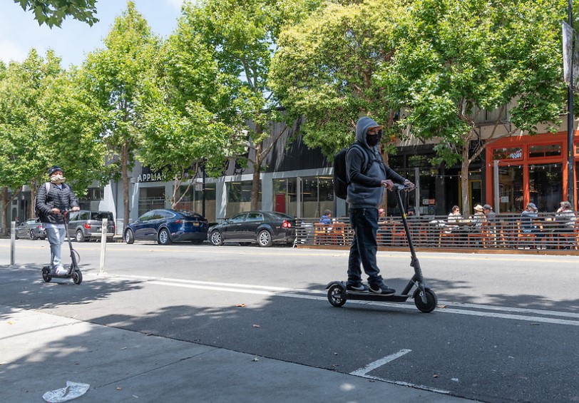
Photo of scooter riders along Valencia Street

Scooter riders along Valencia Street

Background on 2019 Powered Scooter Share Permit Program

The SFMTA issued permits to four companies, Spin, Scoot, Lime and Jump to operate for a one- year term, beginning October 15, 2019. Due to the COVID-19 pandemic, the permits were extended by six months to April 2021.

Recent SFMTA authorization also enabled scooter companies to deploy more scooters and expand into new neighborhoods across San Francisco. This expansion aligns with the agency’s commitment to equity by increasing access to sustainable modes of transportation in underserved areas. Scooters offer an efficient travel choice that is environmentally friendly and fills transportation gaps for many. With reduced Muni service and returning traffic congestion, the city is focused on promoting sustainable ways to get around.

Companies Expanding

Spin was the first company to expand its fleet, by adding 500 scooters in September 2020. With the increase, Spin is authorized to deploy up to a total of 1,500 scooters and is required to meet a minimum distribution of scooters in three more neighborhoods: Inner/Central Richmond, Inner/Central Sunset and the Haight.

Lime acquired Jump in June 2020, and because both companies held a permit Lime is now authorized to operate up to 2,000 scooters. Their permit requires Lime to meet a minimum distribution of scooters in the Richmond and Sunset neighborhoods.

Increased Enforcement and Transparency

As the scooter companies’ fleets expanded, the SFMTA also increased our enforcement and monitoring of scooter share to address compliance and safety issues. For transparency in our effort to increase enforcement sweeps and respond to complaints, we’ve published a Scooter Share enforcement dashboard.

The SFMTA is currently standardizing the process of monthly reporting, which will be available on the Powered Scooter Share Permit Program site.

Get Involved:

Review the Powered Scooter Share Program website for more


Published January 13, 2021 at 05:10PM
https://ift.tt/38DI8FK

الاثنين، 11 يناير 2021

4th Street Bridge Temporary Emergency Transit Lanes Approved

4th Street Bridge Temporary Emergency Transit Lanes Approved
By Erin McMillan

The SFMTA Board of Directors approved the temporary emergency transit lanes project for the 4th Street Bridge (4th Street between Berry and Channel Streets) on Tuesday, January 5, to support improved transit service on Muni’s T Third. Along with other proposed and planned key locations across the city, the SFMTA plans to install a temporary emergency transit lane on the 4th Street Bridge addressing a key bottleneck that delays the T Third line with work scheduled to begin as early as today, Monday, January 11.

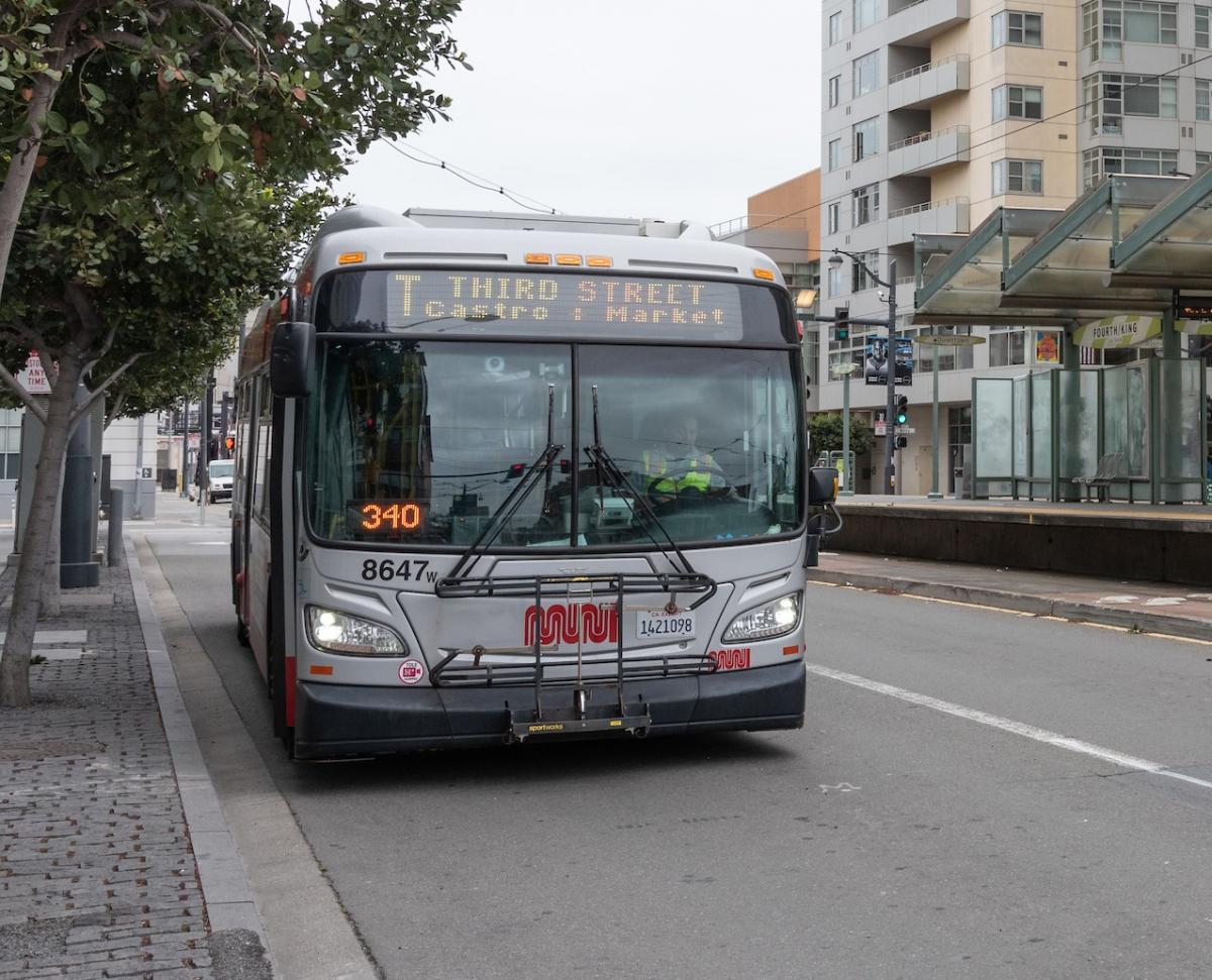
t third bus at bus stop

Installing the dedicated transit lane will allow the T Third trains to move more quickly over the bridge without getting stuck in traffic as the SFMTA prepares for the return of T Third light rail service later this month. Pre-COVID, the combined KT line carried over 42,000 customers daily. Additionally, this will help Muni provide more frequent T Third service and increase physically-distanced capacity with the same number of vehicles. Currently, there are one northbound and two southbound lanes on the 4th Street Bridge. Muni tracks share the lanes with traffic, meaning the T Third often gets stuck in congestion, contributing to delays and bunching throughout the entire line.

The SFMTA Board of Directors approved temporary emergency transit lanes on the 4th Street Bridge in both the northbound and southbound directions. In response to community input, southbound left turns from 4th Street onto Berry Street will continue to be allowed, and there will be a phased approach to implementation of the northbound transit lane depending on site conditions.

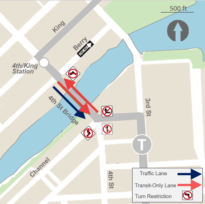
At first, northbound left turns will be restricted from 4th Street onto Berry Street. The left turn pocket at that location will be converted to a transit lane, and northbound traffic will continue to be allowed on the 4th Street Bridge. If northbound traffic still causes delays to the T Third despite these initial changes, a northbound temporary transit lane will be installed between Berry and Channel Streets. With this change, turn restrictions would be implemented at 4th and Channel to prevent vehicles from entering the northbound transit lane, and northbound traffic would be prohibited on the 4th Street Bridge. A summary of this phased approach is provided below.

Phase 1: To be implemented as early as the week of January 11 with evaluation of the changes at least 3-4 weeks after T Third begins service:

  • Southbound transit lane will be installed in one of the two southbound lanes on the 4th Street Bridge
  • Northbound left turns will be prohibited from 4th Street onto Berry Street
  • The left turn pocket in the northbound direction at 4th onto Berry Street will be converted to a transit lane

Phase 2: If the evaluation of Phase 1 shows that auto traffic still causes transit delay on the 4th Street Bridge, despite the Phase 1 improvements, additional changes to be implemented:  

  • Northbound transit lane will be installed in the sole northbound lane on the 4th Street Bridge
  • Northbound traffic will not be permitted on the 4th Street Bridge, making the bridge one-way southbound for general traffic
    • Heading east on Channel, no left turn onto the 4th Street Bridge
    • Heading west on Channel, no right turn onto the 4th Street Bridge
    • Heading north on 4th Street at Channel, no through traffic onto the 4th Street Bridge (right or left turn required)

map of turn restrictions on 4th street bridge

Map shows Phase 2 of the project which will be implemented if an evaluation shows that northbound traffic continues to delay transit service.

Evaluation of the phased approach 

Once Phase 1 has been installed and the T Third resumes rail service, evaluation will include monitoring existing traffic cameras in the area to see if traffic blocks the northbound lane on the 4th Street Bridge more than 5% of the time. In addition to monitoring traffic, we will also monitor train travel times using location data from equipment that is onboard some of the trains to identify the times of day when trains experience the longest travel times on the 4th Street Bridge so that these causes of delay can be further investigated and addressed.

After the initial evaluation of this phased approach and the temporary project is fully in place, an additional evaluation of the full project will take place including a community survey and a technical evaluation of the effectiveness of the temporary transit lanes on the 4th Street Bridge.

Community requests for changes on nearby streets

Engineering staff are still working to determine the design feasibility of community members’ suggestions to allow left turns out of the One Mission Bay garage, conversion of Berry Street between 4th and 3rd to two-way or one-way in the opposite direction, and a dedicated right turn lane at Mission Bay Drive and Berry Street.

For additional information on this project, and to sign up for updates, check out the project webpage at SFMTA.com/TempLanesTThird.


Published January 11, 2021 at 10:47PM
https://ift.tt/3sarwNH

الجمعة، 8 يناير 2021

How Public Input is Helping Shape a Better Market Street

How Public Input is Helping Shape a Better Market Street
By Mariana Maguire

In response to budget constraints and challenges resulting from the COVID-19 pandemic, the Better Market Street project team released updated design proposals for Market Street between 5th and 8th streets in September 2020. We then hosted multiple stakeholder and public meetings, posted a public survey and held a month-long virtual open house in order get feedback on the proposals.

We received and reviewed hundreds of public comments and found four recurring areas of concern:

  • curb lane sharing,
  • speed tables,
  • curbs between vehicle lanes and
  • car-free Market Street enforcement.

Based on these issues, we are proposing the following additional modifications:

  • Lowering the speed limit to 20 miles per hour between Franklin and Steuart streets
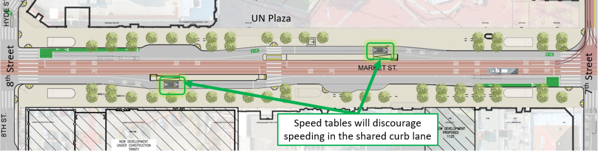
  • Adding speed tables next to boarding islands to slow vehicle traffic and discourage speeding where transit riders and pedestrians are more vulnerable
  • Removing previously proposed mountable curbs between vehicle lanes and explore other ideas for lane separators and
  • Exploring the use of traffic cameras to monitor illegal turns onto Market Street and issue citations in order to improve enforcement of the Market Street ban on private vehicles

We also will make several changes to improve safety for people walking and biking, while maintaining access for taxis and commercial vehicles along the majority of Market Street. These include:

  • Installing signage clearly indicating that taxis and paratransit may use loading zones at all times (already completed) and
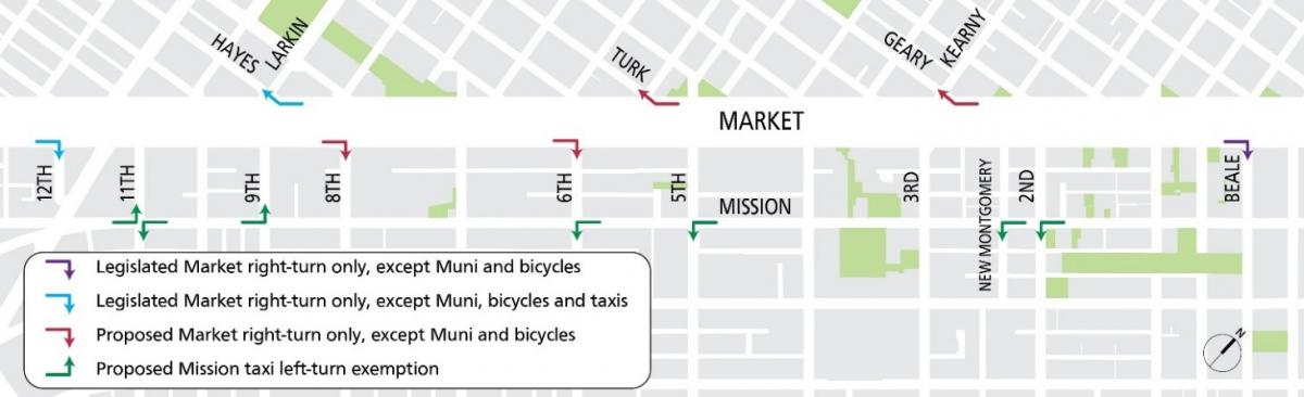
  • Implementing four new required right turns for taxis and commercial vehicles, eastbound at 8th and 6th streets and westbound at Kearny/Geary and Turk streets.

This will further reduce conflicts between motorized vehicles and people walking and biking along one of San Francisco’s highest injury corridors.

Illustration of Market Street showing various turn restrictions

Illustration of existing and new proposed required right turns off Market Street and turn exemptions on Mission Street.

These changes build upon those approved in 2019 including: 

  • Implementing peak hour, peak direction commercial vehicle loading restrictions (6:00 - 9:30 a.m. south side, 3:00 - 7:30 p.m. north side) to reduce conflicts during rush hours
  • Requiring right turns for commercial vehicles at three locations (eastbound at 12th and Beale street, and westbound at Hayes and Larkin street).

Also, exempting taxis from left-turn restrictions along Mission Street (eastbound at 11th and 9th streets, westbound at 2nd, New Montgomery, 5th, 6th and 11th streets) will facilitate taxi mobility along the Mission Street Bus and Taxi only lanes, offsetting the added restrictions on Market Street.

Market Street is one of our city’s busiest areas for people walking and biking. As a part of San Francisco’s high-injury corridor, it includes four of the top ten most dangerous intersections involving collisions for people on bikes and for pedestrians. The creation of a Car-free Market Street initiated the beginning of a safer era for everyone on Market Street. Lowering speeds for the remaining vehicles will further improve safety.

To accomplish this, we propose installing speed tables next to boarding islands. Speed tables help strengthen the 10-mile-per-hour safety zones next to boarding islands and will help reduce overall speeds on Market Street. To discourage speeding, vehicles will not be able to change lanes to avoid the speed tables at the new proposed locations.

Illustration of Market Street between 5th and 8th streets showing placement of speed tables next to boarding islands

Illustration of new proposed speed table locations near boarding islands on Market Street.

Next Steps

On January 19, the SFMTA Board of Directors will consider minor additions to the 2019 legislation, including parking changes on Ellis, Hayes and Fell streets and turn restrictions to support the two-way conversion of Jones Street between Market Street and Golden Gate Avenue, as well as permanent adjustments near 2nd and Stevenson streets that were implemented on a temporary basis as part of car-free Market Street.

To see the public hearing notice for the SFMTA Board of Directors’ meeting on January 19, visit SFMTA.com/BetterMarketStreet. For project details visit the Better Market Street project website.


Published January 08, 2021 at 07:58PM
https://ift.tt/3nr9bbz

الخميس، 7 يناير 2021

Today in History: The Making of the Geary Expressway

Today in History: The Making of the Geary Expressway
By Sophia Scherr

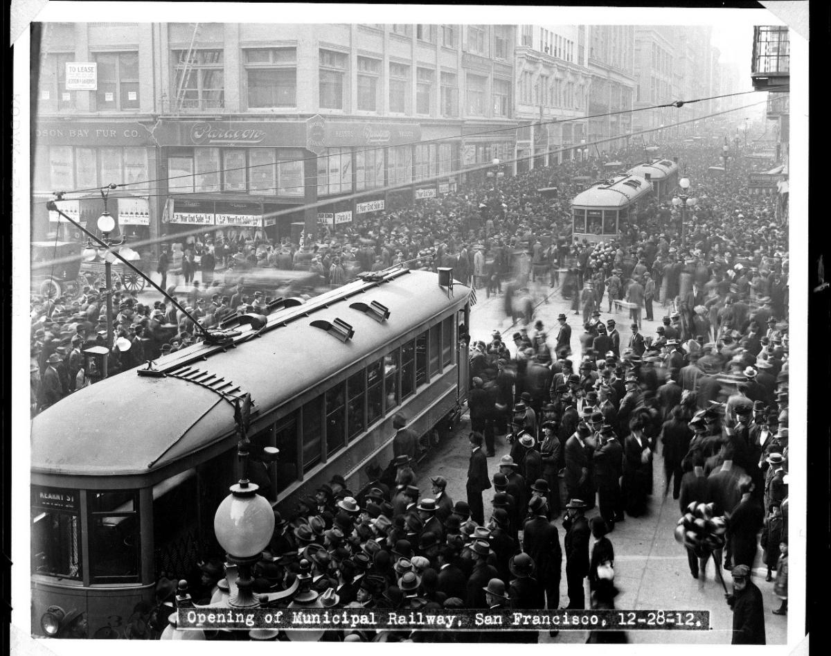
Photo of crowd surrounding two Muni streetcars in downtown San Francisco in 1912

Crowds surround streetcars during their inaugural day of service, December 28, 1912 (SFMTA Photo Archives)

The SFMTA recently celebrated Muni’s 108th Anniversary on December 28, the date when streetcar service was inaugurated along Geary Street between downtown and 33rd Avenue on the A and B lines in 1912. This vital corridor is now experiencing its latest transformation. But first, some history:

Upon opening, for the cost of a nickel, the Geary streetcars went all the way to the Ocean Beach carousel, candy stands and other rides and amusements that would later be known as “Playland at the Beach.” Residences and shops began to spring up amid the sand dunes in the Outer Richmond, as transit connected downtown to the Richmond neighborhoods, Golden Gate Park and Ocean Beach.

The public transit network expanded in the years following this inaugural service through innovative projects like the completion of the Twin Peaks Tunnel and the establishment of the J Church and other lines. Ridership on Geary quickly became among the highest in San Francisco. Today Muni’s 38 Geary and 38R Geary Rapid continue to serve our highest volumes of customers, with more than 56,000 pre-pandemic daily riders expected to return once public health orders are lifted.

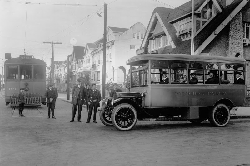
Photo of first motor bus meeting streetcar 101 in December 1917

 Muni's first motor bus (#01) meets streetcar 101 at the end of the A-Geary streetcar line on Fulton Street and 10th Avenue in December 1917. (SFMTA Photo Archives)

With the rise in car ownership, however, "auto fever" demands for automobile-centric developments ushered in the removal of rail infrastructure throughout the City beginning in the 1940s, implementing freeways and expressways in their place. The so-called “urban renewal” campaign of the 1960s and ‘70s also included construction of the eight-lane Geary Expressway, devastating communities by razing homes and storefronts, thereby displacing Black, Indigenous, and People of Color (BIPOC) residents, especially in the Fillmore and Japantown. The Geary Expressway continues to divide these communities as highway-like conditions make it difficult for people walking to cross the street.

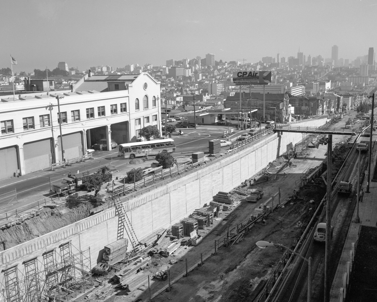
Photo showing the construction of the Geary Expressway tunnel between Presidio and Masonic. 

View east from Presidio Avenue showing the construction of the Geary Expressway tunnel between Presidio and Masonic.

The Geary Rapid Project aims to bring these neighborhoods much-needed transit, pedestrian safety and civic improvements along a 3-mile stretch of the corridor, extending from Market to Stanyan streets, with construction expected to wrap up in summer 2021. This latest transformation comes long after priorities shifted from the mid-20th century focus that originally led to the construction of the Geary Expressway.

While we can never undo all the harm caused by this roadway, the Geary Rapid Project brings transit improvements and safety for people walking, developed in partnership with the communities most affected by the Geary Expressway construction. These improvements include travel time-reducing transit lanes, bus-bulb outs that reduce crossing distances for people walking and traffic signal upgrades. The project also includes a host of Vision Zero safety and accessibility benefits, to calm the expressway and make this high-injury corridor safer for people walking.  

Construction on Geary has continued smoothly throughout the COVID-19 pandemic and the project reached several, major milestones in 2020:

  • 1.5 miles of sewer and 1.8 miles of water upgrades were completed,
  • 30 new bulb-outs were installed and
  • crews removed the Steiner pedestrian bridge over Memorial Day weekend (see a time-lapse video here). The bridge will be replaced with improved surface crosswalks with larger pedestrian medians, including a new crosswalk on the east side of the intersection.

In addition to these improvements, “Muni head-start traffic signals” were recently turned on along Geary at 25th, 20th and 15th avenues as part of the 38 Geary Temporary Emergency Transit Lanes project. The signals give the 38 Geary and 38R Geary Rapid the go-ahead to start before other traffic, while also giving a head start to people walking across the street. The and new temporary transit lanes will be a welcome time-saver and help address crowding for people making essential trips as San Francisco begins reopening.

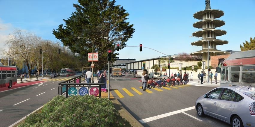
Artist's endering shows people crossing Geary using the median crossing being built at Geary and Buchanan streets.

A rendering shows people crossing Geary using the median crossing being built at Geary and Buchanan streets.

Final touches on Geary include a special community-centered crosswalk with decorative panels at Buchanan Street. The crosswalk symbolizes the re-connection of the two communities (Japantown and the Fillmore) that were separated by the Geary Expressway. The crosswalk design and development resulted from a close collaboration between the SFMTA and the local communities as a part of our commitment to better serve the city’s residents.

As the Geary Rapid Project wraps up construction later this year on time and on budget, we look forward to cutting the ribbon on a better Geary that both Muni customers and people walking can enjoy once San Francisco opens again.


Published January 07, 2021 at 09:39PM
https://ift.tt/3s3g3PU

الأربعاء، 6 يناير 2021

Why Does Construction Take So Long?

Why Does Construction Take So Long?
By Amy Fowler

Tired of construction in San Francisco? You are not alone. With so many city projects and private developments raising dust across the city, our iconic skyline can more closely resemble a giant Erector set than a world-class city. Without these necessary upgrades, however, roads would crumble, traffic signals would be stymied by aging technology and century-old sewer and water pipes would be vulnerable to earthquakes and climate change.
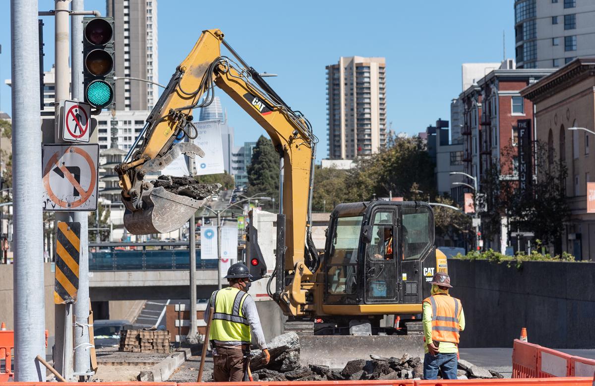
 Photo of pedestrian refuge island under construction at Geary Boulevard and Steiner Street as part of the Geary Rapid Project.

New pedestrian refuge island under construction at Geary Boulevard and Steiner Street as part of the Geary Rapid Project.

But why does construction take so darn long?

There are many factors that can turn a seemingly simple project into an extraordinarily complex undertaking. Chief among them is that many SFMTA projects are done in the public right of way. Unlike private developments that are usually self-contained, our projects happen in areas where people need to walk, drive, bike and take transit.

Considerations like traffic control, maneuvering around existing utilities, providing adequate space for construction crews to work and maintaining access to neighboring businesses and homes all take a considerable amount of coordination. There may also be impacts to transit that require relocating a bus stop or safely rerouting people walking around construction sites. Support from utilities is often required when working around existing electrical wires, or additional SFMTA staff may be needed to isolate the overhead contact system that powers our zero-emissions electric-trolley buses.

There are also trade-offs to work out, like storing construction materials in a location that’s close enough for crews to work efficiently without causing too great a disruption to the neighborhood. And on busy thoroughfares like Van Ness Avenue or Geary Boulevard, all the work must happen within limited hours of the day to maintain traffic flow.

Every element of a project must be sequenced properly so that all the parts can move in sync. It’s like tipping over a stack of dominoes: if one of those dominoes gets moved due to a conflict, schedules or crews may need to be reshuffled to keep the overall work from being delayed.

So what about those trenches that are dug up, filled and then re-dug?

Underground utility work like replacing aging water or sewer mains is time-consuming and often requires trenches to be opened, covered and opened again. First, smaller holes are dug—a process called “potholing”—to determine the location of any existing utilities that may not appear accurately on utility records, including electric or gas lines. Then the work trench is carefully excavated, and any old or abandoned utilities that are in conflict are removed before the new pipes can be installed. In some cases, the project must be redesigned if unforeseen obstacles cannot simply be removed.

Water pipes must be disinfected and tested before reconnecting a property’s water service to a newly installed main; on some blocks there may be dozens of individual switchovers. Trenches must be covered the at the end of each shift for safety reasons and to restore travel lanes to vehicle traffic. Only when these steps are complete can crews restore the work area with a strong concrete base above the trenches and repave the roadway.

Another reason projects can be lengthy lies in the city’s excavation code, which aims to coordinate agencies’ work. The SFMTA works in close collaboration with our city partners in the Planning Department, Public Utilities Commission and Public Works to combine utility, transit, safety and streetscaping improvements into one package—which can sometimes make a project longer but means we don’t have to come back and tear up the road again every few years. Coordinating transit improvement projects with other planned work can therefor reduce overall disruption to communities and save money by reducing the amount of excavation needed.

Projects like Central Subway and the Van Ness, Geary Rapid and L Taraval Improvement are no exception when it comes to complexity. Each project has its own unique challenges based on existing conditions, scope of work and community considerations that can affect how work is sequenced.  

The SFMTA works closely with contractors, local businesses and residents to minimize construction impacts to the community. We know how difficult construction can be when it’s right at your doorstep, and we’re grateful for your patience as we work to build a better San Francisco.  
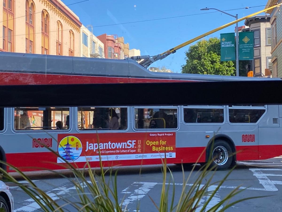
Muni Bus with sign advertising Japantown Open for Business

A Muni bus sign encourages visitors to Japantown, part of the Geary Rapid Project’s business support program. SFMTA projects include construction mitigation plans tailored to suit the local neighborhood and offset potential impacts.


Published January 06, 2021 at 08:44PM
https://ift.tt/3rXQ501
الثلاثاء، 5 يناير 2021

22 Fillmore Moves to Mission Bay, Makes Way for the 55 Dogpatch

22 Fillmore Moves to Mission Bay, Makes Way for the 55 Dogpatch
By Erin McMillan

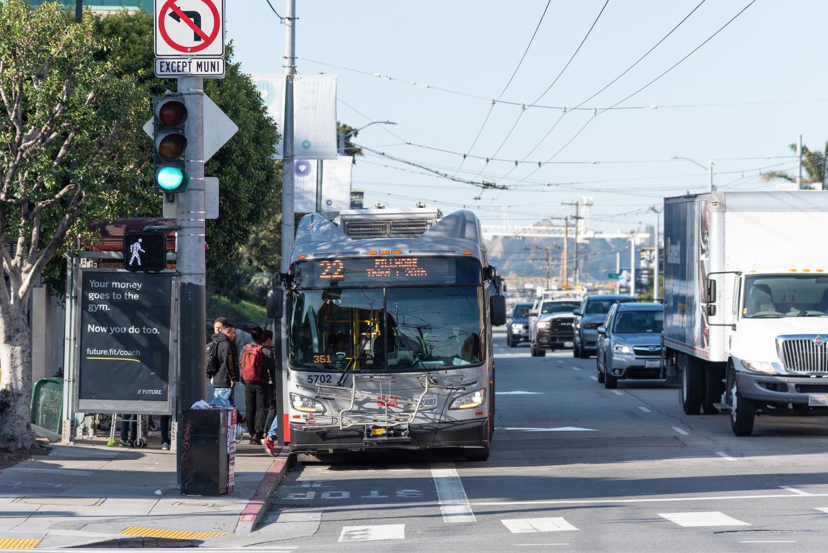
22 Fillmore bus boarding passengers at bus stop.

Starting Saturday, January 23, the eastern section of the 22 Fillmore will shift its route to begin serving Mission Bay. Utilizing the new transit and street amenities along 16th Street, the 22 Fillmore will travel east from the Mission to 3rd Street to serve medical facilities and the growing residential and commercial areas in the Mission Bay neighborhood. In addition to increasing service to the Mission Bay neighborhood, this move will provide an improved east-west connector from the Mission neighborhood to Mission Bay, increasing transit access to jobs and healthcare services. This 5+ mile bus route serves nearly 18,000 daily customers from the Marina through the Mission and soon to Mission Bay, improving Muni service to all the neighborhoods in between.

Start of the 55 Dogpatch

Moving the eastern segment of the 22 Fillmore to Mission Bay provided an opportunity to work with the communities of Potrero Hill and the Dogpatch to find ways to improve transportation in their neighborhoods. Beginning with an initial assessment of transportation options and potential future development in the area, SFMTA worked to find what type of transit service would best serve these neighborhoods. After a few years of research and extensive outreach, the community-informed 55 Dogpatch was born as a new Muni route to maintain and enhance transit connections between 16th St Mission BART, Potrero Hill and the Dogpatch. Service on the 55 Dogpatch will also begin on Saturday, January 23.

These adjustments to Muni service comes after the completion of the first phase of the multi-agency 16th Street Improvement Project from Potrero Avenue to 3rd Street that includes new signalized intersections, new transit islands and transit bulbs for safer and more efficient bus boarding, new pedestrian bulbs to reduce crossing distances for people walking, new ADA ramps at each intersection, new street lights to illuminate the streets, 50 new trees along 16th street, curb-to curb paving and new sewer and water pipes. The completion of this phase means a safer and overall more pleasant experience for the community, Muni customers and people walking. This project made community-informed improvements to address the needs of current and future residents and is part of Muni Forward, an initiative to create a safe, reliable and comfortable experience on and off transit.

Additional information about all service changes that are planned to begin on Saturday, January 23 can be found on our blog.


Published January 05, 2021 at 10:31PM
https://ift.tt/3pRKXbV

الأربعاء، 30 ديسمبر 2020

Get Active with Your New Year’s Resolution

Get Active with Your New Year’s Resolution
By Benjamin Barnett

Do you want to make a change in 2021 that reaps rewards? An easy way to do that is to pick an active travel option for your trips around town. Sticking to a New Year’s resolution can be hard to do, but choosing an active way to get around is one small thing that can make a big difference.

“Active mobility” is the industry term that describes how people move around the city using any non-motorized means of physical activity. The best-known examples of active mobility are walking and bicycling, though other modes include running, skateboarding, scooters and roller skates. Whatever way you choose to be active when you are going to the grocery store, the doctor or to other essential places, you’ll be rewarded for your efforts.

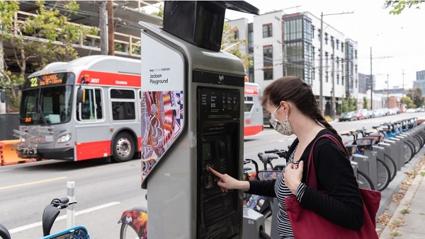
Woman uses bikeshare station while Muni 22 bus drives past

Staying Healthy

One benefit of choosing active mobility is stress reduction. Making your trips by foot, bicycle or skateboard gets your heart rate up and brings your stress levels down. The COVID-19 pandemic has brought a great deal of additional stress into our lives. We’re not only juggling multiple roles at home and the associated time constraints that places on us, we’re also worried about ourselves and our families becoming ill, while also dealing with economic and emotional issues.

Active modes of transportation can also help protect you from serious diseases such as stroke, heart attack, some cancers, depression, diabetes, obesity and arthritis. Riding a bike is healthy, fun and a low-impact form of exercise for all ages. Walking is easy to fit into your daily routine by strolling to shops, parks, school or work. It also reduces negative health problems that can arise from inactive and sedentary lifestyles. The US Centers for Disease Control recommend increasing frequency of active transportation as a great way to stay healthy and improve physical fitness.

Better for the Environment

Another benefit of active mobility is reducing greenhouse gas emissions to slow global warming. Every year, a typical American car emits 4.6 metric tons of carbon dioxide. Rising automobile use is increasing these greenhouse gas emissions and escalating the rate at which the Earth’s atmosphere is reaching a climate tipping point. Active mobility lowers daily greenhouse gas emissions, helping us back away from that tipping point.

You’ll also be reducing air and noise pollution by making your trips out and about more physically active. Air pollution negatively affects human health and the environment causing acid rain, excessive algae growth in bodies of water, haze, wildlife deaths, thinning of Earth’s ozone layer, crop damage and global climate change. Noise pollution disrupts ecosystems and wildlife, as well as the lives of people in urban and suburban areas. Active mobility reduces air and noise pollution by replacing car trips that produce greenhouse gases and noise, benefiting the environment and urban ecosystems.

Make a Better Choice

And of course, you benefit your neighbor when you choose  an active mode of transportation to get around. You free up space on Muni for those who have no other options. You also avoid traffic delays and can enjoy seeing your city from a different perspective. With this easy resolution, you’ll be able to emerge from these unprecedented times with a change that you can be proud of.


Published December 30, 2020 at 06:40PM
https://ift.tt/3aPbgvg